更新日期:2020.5.1

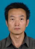
| 姓名: | 温兴平 |
职称职务: | 教授 |
学位: | 博士 |
电话: | 15025148278 |
电子邮箱: | wfxyp@qq.com |
研究方向: | 遥感技术应用 |
2005年9月-2008年7月,中国地质大学(武汉)资源学院学习。
2008年7月至今,昆明理工大学国土资源工程学院教师。
国家自然科学基金:天空开阔度对城市热岛效应的影响研究。
云南省应用基础研究计划项目:高光谱遥感矿物精细识别示范研究。
张皓楠; 温兴平; 徐俊龙; 罗大游; 一种混合像元高光谱测量装置. 2019.
Xu Junlong; Wen Xingping*; Zhang Haonan; Luo Dayou; Li Jinbo; Xu Lianglong; Yu Min; Automatic extraction of lineaments based on wavelet edge detection and aided tracking by hillshade[J], Advances in Space Research, 2020, 65(1): 506-517.
Xu Junlong; Wen Xingping*; Zhang Haonan; Luo Dayou; Xu Lianglong; Wu Zhuang; Multi-scale characteristics of remote sensing lineaments[J], Earth Science Informatics, 2019.
Zhang Haonan; Wen Xingping*; Xu Junlong; Luo Dayou; Li Jinbo; Study On The Spatial Expansion Of Garden City Under The Ecological Green Spaces Protection (Qujing Area, China)[J], Applied Ecology And Environmental Research, 2018, 16(4): 4717-4734.
温兴平,遥感技术及其地学应用[M],北京:科学出版社,26.2万字,2017。
Wen Xingping; Yang Xiaofeng; Hu Guangdao; Relationship Between Land Cover Ratio and Urban Heat Island from Remote Sensing and Automatic Weather Stations Data[M], Journal of the Indian Society of Remote Sensing, 2011, 39(2): 193-201.
温兴平; 胡光道; 杨晓峰; 卫星遥感像元邻近效应的模拟试验[J], 红外与毫米波学报, 2009, 28(1): 46-49,65.
温兴平; 胡光道; 杨晓峰; 基于准不变反射率地物下CBERS-02星CCD图像的交叉定标[J], 武汉大学学报(信息科学版), 2009, 34(4): 409-413.